Western Reserve Greenway (szlak turystyczny) Hoteli
Rekomendowane hotele w pobliżu: Western Reserve Greenway (szlak turystyczny)
Więcej hoteli w pobliżu Western Reserve Greenway (szlak turystyczny)-
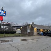
 2329 North Ridge East, Ashtabula, Ohio 44004, US Pokaż mapę
Economy Inn And Suites Ashtabula
W czasie pobytu w obiekcie takim jak Economy Inn And Suites Ashtabula znajdziesz się w samym centrum miasta Ashtabula pięć minut samochodem od atrakcji... Więcej
5.8/10Fair110 recenzji3.2 kmBezpłatny Wi-FiWybierzOd USD 478za pokój / za noc -
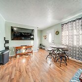
 1421 Norwood Dr, Ashtabula, Ohio 44004, US Pokaż mapę
Ashtabula Home Rental - 2 Mi to Lake Erie, Beaches
W czasie pobytu w obiekcie takim jak ten domek letniskowy w mieście Ashtabula zamieszkasz 15 minut piechota od atrakcji takich jak Jezioro Erie i Centrum... Więcej
3.8 kmBezpłatny Wi-FiWybierzOd USD 197za pokój / za noc -
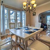
 1505 W 6th St, Ashtabula, Ohio 44004-3311, US Pokaż mapę
1 Block to Bridge Street: Lake Erie Vacation Home!
W czasie pobytu w obiekcie takim jak ten domek letniskowy w mieście Ashtabula zamieszkasz 15 minut piechota od atrakcji takich jak Jezioro Erie i Muzeum i... Więcej
4.3 kmBezpłatny Wi-FiWybierzOd USD 211za pokój / za noc -
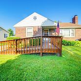
 717 Norman Ave, Ashtabula, Ohio 44004, US Pokaż mapę
< 1 Mi to Lake Erie: Ashtabula Hideaway!
W czasie pobytu w obiekcie takim jak ten domek letniskowy w mieście Ashtabula znajdziesz się pięć minut samochodem od atrakcji takich jak Jezioro Erie i... Więcej
4.4 kmBezpłatny Wi-FiWybierzOd USD 167za pokój / za noc -
 533 GOODWILL DRIVE, Ashtabula, Ohio 44004, US Pokaż mapę
Riverbend Hotel and Suites, Trademark Collection by Wyndham
W czasie pobytu w obiekcie takim jak Riverbend Hotel and Suites, Trademark Collection by Wyndham w mieście Ashtabula znajdziesz się w dzielnicy... Więcej
4.6 kmBezpłatny Wi-FiWybierzOd USD 171za pokój / za noc -
 1309 Harmon Rd, Ashtabula, Ohio 44004, US Pokaż mapę
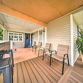
Wine Valley Bungalow
W czasie pobytu w obiekcie takim jak Wine Valley Bungalow w mieście Ashtabula znajdziesz się w dzielnicy historycznej, 15 minut piechotą od atrakcji takich... Więcej
5.0 kmBezpłatny Wi-FiDodatkowe informacje:Wybierz -
 1117 Chestnut Drive, Ashtabula, Ohio 44004, US Pokaż mapę
Private Waterfront Lake Erie Home w/ BBQ Patio
W czasie pobytu w obiekcie takim jak ten domek letniskowy w mieście Ashtabula znajdziesz się 1 minut piechotą od atrakcji takiej jak Jezioro Erie i 12... Więcej
5.3 kmBezpłatny Wi-FiWybierzOd USD 478za pokój / za noc -
 1831 Austinburg Rd, Austinburg, Ohio 44010, US Pokaż mapę
Holiday Inn Express Hotel & Suites Ashtabula-Geneva by IHG
Holiday Inn Express Hotel & Suites Ashtabula-Geneva by IHG znajduje się w mieście Austinburg, na wsi i pięć minut samochodem od atrakcji takiej jak Park... Więcej
8.4/10Dobry418 recenzji9.0 kmBezpłatny Wi-FiWybierzOd USD 179za pokój / za noc